Wagon
Cabin
tabtab

Home
The Trail
Bluff Fort
history
The Foundation
Contact Us
Donate


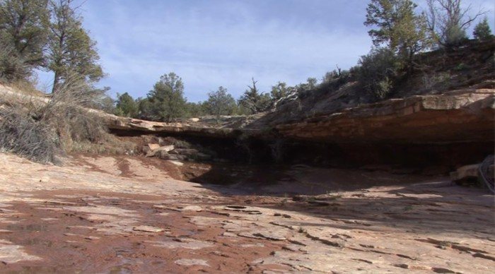
Site 16, Dripping Springs Area
From Clay Hills, they turned northward to bypass Grand Gulch. Springs located at the head of tributary canyons leading into Grand Gulch, such as Cow Tank and Dripping Springs, were used as campsites. The terrain through this area was very rugged as their route dropped into and back out of the steep tributaries.


Scroll down to view full gallery.
 
 
Still Images - click to enlarge

   
Dripping Springs -- The space under the rock ledge is large enough to provide shelter for about ten people. Lamont Crabtree Photo
Dripping Springs
     
Image submittals are welcome! We are particularly interested in photos prior to Lake Powell. Click on "Contact Us" for details.


Home
|The Trail|Bluff Fort|Histories|HIR Foundation|Contact Us|Donate
© Copyright Hole-in-the-Rock Foundation ® 2008


The Hole-in-the-Rock Foundation Preserving the History and Sharing the Legacy


Wednesday, March 10th, 1880. "Returned this evening from a 5 days trip with bros Sevy and Bryson looking for a road across what we call the Cedar Ridge extending 30 miles each way and nearly everywhere covered with a dense growth of cedar and pinion pine. We found gulches with perpendicular banks 1000 feet high running from the extreme north 30 miles into the San Juan on the south, but by going around the head of these we can make a passable road by following an old indian trail. There is plenty of grass and some water most of the way. Found that the brethren had nearly completed the road down the hill."
Platte D. Lyman