Wagon
Cabin
tabtab

Home
The Trail
Bluff Fort
history
The Foundation
Contact Us
Donate


Site 3, The Kaiparowits Plateau
The pioneers’ route from the town of Escalante ran parallel to the base of the Kaiparowits Plateau, which towers above the desert by as much as 2200’. The watershed of the Kaiparowits fed the numerous springs, which were essential for the pioneers’ survival. On one occasion, the advanced scouts climbed part way up the plateau to get a better vantage point from which to examine the terrain east of the Colorado River gorge with a monocular.


Scroll down to view full gallery.
 
Video Clips - click to load viewer
 
Hole-in-the-Rock/River Gorge - winter conditions, Lamont Crabtree Photo
Kaiparowits Plateau
Hole-in-the-Rock/River Gorge - winter conditions, Lamont Crabtree Photo
Kaiparowits Plateau
 
Still Images - click to enlarge

   
Kaiparowits Plateau -- Fifty Mile Point in the distance. Lamont Crabtree Photo
Kaiparowits - Fifty Mile Point
 
Sunrise on the Kaiparowits. Lamont Crabtree Photo
Sunrise on the Kaiparowits
   
Image submittals are welcome! We are particularly interested in photos prior to Lake Powell. Click on "Contact Us" for details.


Home
|The Trail|Bluff Fort|Histories|HIR Foundation|Contact Us|Donate
© Copyright Hole-in-the-Rock Foundation ® 2008


The Hole-in-the-Rock Foundation Preserving the History and Sharing the Legacy


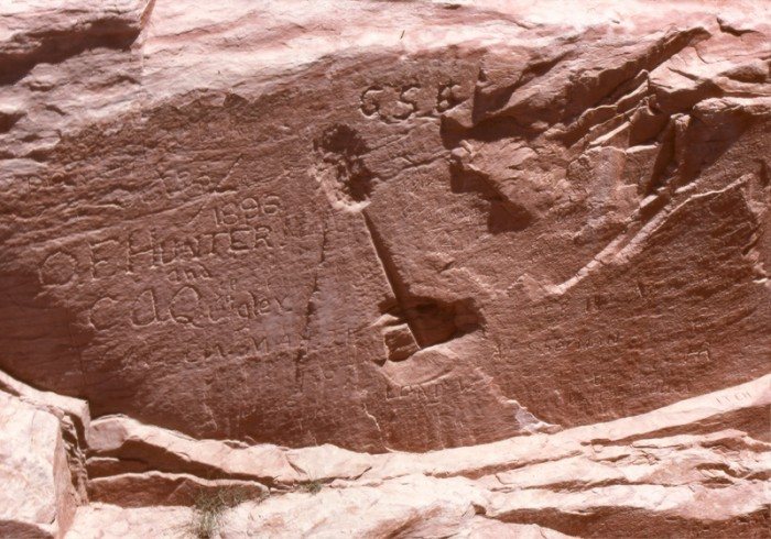
Wednesday, Nov. 26th, 1879. "Bros Schow, Collet Eddy and myself climbed a high point of the mountain close by and endeavored with the aid of field glasses to make out something of the country ahead of us but could not. Returned to camp and found that Joseph had undertaken to move some of our wagons and had them scattered all the way from one camp to the other."
Platte D. Lyman